Sunday, August 28, 2016

Mountain Music, Visitors, and Stony Fork Campground

We are camping in the Jefferson National Forest, about 10 miles from the little city of Wytheville, Virginia. We have been here long enough to know that it is pronounced "With-vil," so we didn't embarrass ourselves among the locals by saying it incorrectly. Even though we wouldn't say that Stony Fork Forest Service campground is the ideal place to camp, we are settling in for a few days. Without television or computer, cramped with no slide-outs, and limited to the amount of water in our fresh water tank, it's not the most comfortable camping experience.

The weather hasn't cooperated either. We planned to do the five mile Seven Sisters trail--named after the seven hills that the hike crosses on the ridge of the mountain. But we got rain every day, so we didn't have enough dry weather time to take a long hike.

The highlight of our stay here was a visit from new friends. We had spent a few days parked next to Joe in Gaffney, South Carolina, while we both waited our turn for service at the Freightliner shop. His wife, Dotty, hadn't made the trip for the motor home's oil change, so we didn't get to meet her then. When Joe went home to West Virginia, we promised that we would let him know when we were traveling in his area. It seems he wanted to introduce his wife to this crazy couple from Oklahoma. When we got to this area north of Wytheville, Virginia, we realized we were around 50 miles from Joe. We were delighted when Joe and Dotty drove all the way to our campground to see us.

We got to visit (as it rained outside) inside our cramped motor home, and then we made the trip into Wytheville to eat. We landed at Skeeter's--where they have sold over 9 million of their "world famous hot dogs." We had to order a hot dog, but we all agreed that the flounder fish dinners were better than the dogs.

Then we wandered down Main Street, to take a picture of one of the world's biggest pencils. At 30 feet in length, Mark had to back up a long ways to get all three of us and the entire pencil in the photo. It looks like a wooden pencil, but is actually made of metal, and it has been guarding Main Street in Wytheville for over 60 years.

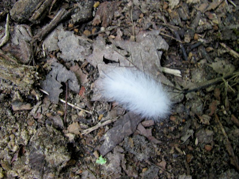
We always appreciate advice and insights from locals, and it was fun to get that from Joe and Dotty. We mentioned a very woolly caterpillar we had seen on a recent hike, and had been told that was an indication of a hard winter ahead. Dotty also mentioned that the number of foggy days in August foretold the number of snows in winter. We have seen a lot of fog in this area in the few days we have been here. From all indications, it looks like we need to get out of here before the record-breaking snowy winter ahead.
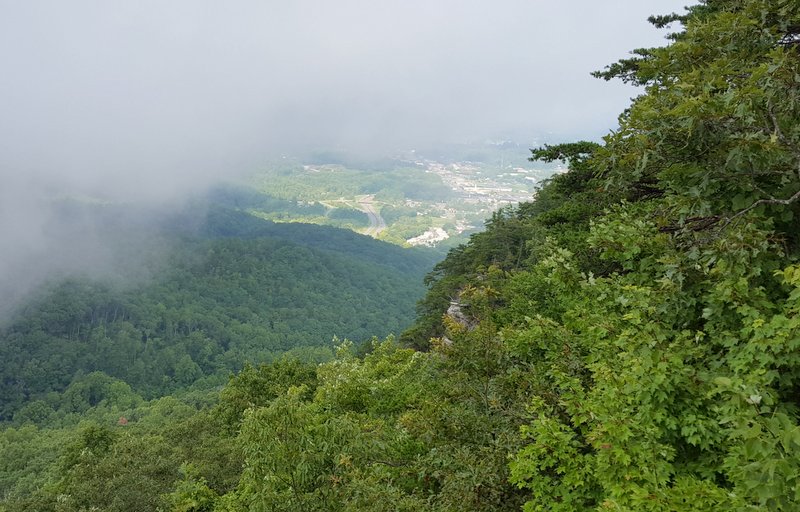
In between rain showers, we visited other Virginia oddities. That would include the tower at the top of Walker Mountain. At an elevation of 3,405, the view from Walker Mountain was already very nice.

But a six dollar ticket would buy the opportunity to cross the swinging bridge and climb to the top of the Big Walker Lookout Tower. Considering it was sprinkling rain when we arrived, we didn't opt for the tower ticket.

We were really here for the live music. Every Saturday and Sunday afternoon, the BW Country Store hosts bluegrass music on their front porch.

This group was quite good, and we enjoyed the sing-along songs as the rain poured down. We were glad there were picnic tables and chairs under a roof so we could listen without getting wet.

Just to our left was another mountain overlook. This was the view of the Civil War Battle of Wytheville in July, 1863. Since we are now in Virginia, it just seemed appropriate that a Virginia Creeper plant was growing up the old wooden fence that was protecting the edge of the viewpoint.

As we listened to the music, we were also entertained by the resident hummingbirds. This guy almost blended in with metal holder as he sat atop the feeder that he had claimed. But if any other hummingbird tried to drink that nectar, he sprung into action to drive them away.

A different feeder by the window was not guarded, and hosted a wide selection of little birds that were better at sharing. The wall of old license plates next to the hummingbird feeder featured some very old ones. But we recognized a relatively new Oklahoma plate in the upper left hand corner of the picture below, and wondered how it had made its way there.

The front porch music we had just enjoyed was free, and part of a state-wide program called the "Crooked Road Music Trail."

On their web-site, we saw that another performance was slated that evening at Wytheville Community College Auditorium. We were there for the 7:00 opening that started with Adam McPeak and the Mountain Thunder. Last week there was a huge bluegrass competition in Galax, Virginia, and we were sorry that we missed it. The audience applauded when it was announced that this band was ranked 10th among the 162 bands in the competition.

After an hour of their gospel and blue grass music, another group took the stage. The Mountain Park Old Time Band specializes in something called, "old time music." They featured the usual instruments, but they also had a washboard-playing percussionist. This "heavy metal" player also doubled as a flat-foot dancer on some songs. He brought out his wooden square that could make any surface into a dance floor, and danced a very calorie-burning version of the Virginia flatfoot. The band encouraged people in the audience to come to the front of the auditorium to dance.

Denisa is not one to turn down an invitation, even if she doesn't know the dance. She got some instruction from one of the locals on how to flatfoot, and got some good exercise too. Mark got the night off, since the flatfoot is a one-person dance. Together we danced to a couple blue grass numbers that had a two-step beat, but Mark got to enjoy most of the concert from his chair this time.

We always like to find a local farmer's market, and we hit the jackpot here. We went first to the Saturday morning market in downtown Wytheville, featuring baked goods, home-made popsicles, and a nice selection of home-grown vegetables.

Then we headed to Williams Orchard, about ten miles down the road. After a very warm autumn, the local fruit trees started blooming too early and met with a heavy frost in December. So Williams has to truck in apples and peaches from North Carolina this year. Between our two market stops, we bought an impressive display of produce. Even if our camping spot isn't ideal, we'll be eating lots of beautiful fresh fruits and vegetables this week!

Before we left this area, we attended worship in a little white church just down the road on Sunday morning. We broke another attendance record for us that morning, as we were two of only eight people in church. The 92-year-old patriarch recalled that there used to be as many as 160 people in this church in his younger days. Considering that we were the youngest people in a congregation that isn't used to having visitors, we were welcomed with open arms. That is what we have found all over the south--that southern hospitality has always made us feel welcome.

Friday, August 26, 2016

We knew there would be days like this . . .


We recently had “one of those days” when nothing seems to go right. So in the interest of full disclosure of this full-time RVing lifestyle, we thought we would share our recent travel day in Virginia. 

You might be wondering why there would be pictures of mushrooms dispersed throughout this blog. Well, there was nothing to take pictures of during our day of mishaps. The next day we took a hike filled with lots of unusual fungus, but no story. So today we will put the non-picturesque story with the non-story hiking pictures to make one very confusingly illustrated blog.

It all started when we decided to leave our lovely spot at Cumberland Gap National Park. We had been wonderfully spoiled with new friends and great hikes, and it would have been easy to stay several more days. But we are trying to push north towards cooler weather, and to position ourselves to be in an area that will have nice fall foliage. We usually drive 1-2 hours when we relocate to a new campground, but this day we were planning to drive 3.5 hours. We left earlier than usual, because there were storms approaching from the east.

It was a lovely drive through the Appalachian Mountains. We climbed up over Powell Mountain, and then back down. We enjoyed the fact that the highway was situated in a valley that had been cleared of trees, so we could actually see the farms and homes in front of the mountains. (Look at that--we actually included a picture that makes some sense with the story!)

We usually travel with our big-rig GPS on the dash, with Denisa holding a smart phone programmed to go to the same destination. Denisa also keeps a paper map on her lap, just to make sure the technology sources don’t lead us astray. But we haven’t been to a Virginia Welcome Center to pick up a map, so we only had two navigational tools. Perhaps that was the problem.

We are used to the two different GPS’s disagreeing. Sometimes the big-rig GPS is just too careful with its routes, and takes us many miles out of our way. So we blindly turned when the phone GPS lead us to a side road that would save us mileage as it angled to our next turn.

That was a mistake! We should have taken pictures of the narrow, winding residential area that we had turned onto. But we didn’t have time to think about pictures, we were too worried about getting off this road. It wasn’t even wide enough for striping. But the worst part were the electrical lines that were haphazardly strung across the road at very low heights. Denisa was ducking her head inside the motor home, somehow hoping that would make us low enough to pass under them. When we tweaked one with our CB antenna, we wondered if the electrical line was trailing behind us. We ducked and meandered at 15 mph down this little alley, hoping it would come to a larger road soon.

Several miles later we did get to a larger road, and felt better about our journey. We had programmed a stop at the Virginia Welcome Center so we could get a map and some information. But for some reason the GPS took us to the street directly behind the welcome center. We should have learned our lesson, but again we were following the GPS down a steep and winding road with no markings. It was so steep that we drug the tow car's hitch as we went down. Our mood was sinking right along with the road.

We made it to the GPS pin—the backside of the welcome center with no parking and no entry. We had to take another 6-mile detour, driving through business and residential traffic, to get us back to the interstate and the correct parking lot. By this time Mark needed a break from the stress of driving! But we did get that Virginia map that we needed. We also took a picture of Denisa loaded down with travel brochures at their “Virginia is for Lovers” sign out front.

We are only half-way to our destination, and the rain storm is chasing us. Mark is running the windshield wipers, as we get to a construction area with slow downs.

After over four hours on the road, we finally arrive at the National Forest Service campground. We are a little leery of the signs at the entrance proclaiming this a flood-prone area. This is especially worrisome since we are forecast to get rain for the next four days. The "flash flood" sign is right in front of one of the four low-water bridges we must cross in the camp ground.


As we travel into the campground, the tree limbs are hitting the top of the motor home. It looks like we are the tallest vehicle that has passed this way in a while. We pick a nice site, but find that is it more unlevel than it looked. Even after we back onto four jack pads, we are still down in the back and one side. The jacks are stretched to their maximum to bring us to level, and this makes Denisa uneasy. Do we need to mention that it is also starting to rain by this time?

This is where Denisa and Mark have different philosophies. Mark would say that we should get the motor home as level as possible and put out all four slides to make it nice and comfortable inside. But Denisa would say that we’re probably just staying for two or three nights, so we don’t need to stress the jacks and the frame by putting out those heavy slides on a site that's not level. Besides, when the creek floods, perhaps we can drive away quick enough to avoid being swept away to our deaths if we don’t have to take the time to put all the slides back in. That scenario might be a little dramatic, but Mark reluctantly agreed to give up comfort for his wife’s peace of mind.

We knew our site would only have electricity, but we were told that we could load up water from spigots scattered throughout the campground. But they didn’t tell us that none of the spigots were threaded for a hose. So we now are faced with strict water conservation, as we are limited to the amount of water we have in our tank. It’s been one of those days.

As Denisa went inside the motor home to set up housekeeping, she found that the rug in front of the refrigerator was wet for some unknown reason. She also found that the vegetable oil had tilted in the cabinet, and had been trickling out onto the shelves below it. She found a little piece of broken black plastic of unknown origin on the floor. That means something somewhere is broke. Then the carbon monoxide alarm went off for no apparent reason.

In the meantime, Mark is doing his technology checks. We have absolutely no over-the-air television stations, so there will be no Olympics for us during this stay. We have a little telephone signal he can boost. But we have no data service for our computers. We can do without television and computers, but we really don’t like it.

By this time we are grumpy with each other, tired from a long and treacherous trip, and concerned about the source of the water on the floor. We can’t spread out inside because the slides are in, and by this time the rain storm is raging outside.

We knew there would be days like this! Even though most days are fun and most moves are uneventful, this one was neither.


But the good news is that we survived this evening’s storms, just like the other storms that life brings our way. Now we are happy to be here at Stony Fork Campground, but the stay will probably be short. In the meantime, between rain storms, we took the one-mile nature trail hike. The pictures in the blog today are of the glorious array of unusual mushrooms and other things growing throughout the forest. They were thriving from all the rain showers that were complicating our life. So there is probably a lesson to be learned this day. We knew there would be days like this!

Thursday, August 25, 2016

Saying Farewell to Cumberland Gap National Historic Park

After three great days in Cumberland Gap National Historic Park, we are a little sad to be leaving. But we had one final hike on our last day, led once again by our new hiking friend, Jan. Again, we started early to beat the heat, and Mark took this picture as the sun was rising over the tree tops.

Today we were a group of four, as one of the other camp hosts, Tullo, was joining us. We appreciated the shade of the tall trees that surrounded us, as we started on the trail right at our campground.

We are heading up Lewis Hollow Trail, and the key word here is "up." Jan had told us this section was like being on a stair-stepper, and she was certainly right. We are pictured here taking one of many breaks on our way up to the ridge of Cumberland Mountain.

Denisa and Mark are both modeling towels around their necks for our third hike in this Virginia heat. We have learned from our experienced hiking friends this week that a wet towel is good for cooling off on a hot hike.

As we hiked higher into the mountains, we caught up with a blanket of fog. It was a cool and eerie sight to walk through the clouds on the top of the peak.

The 100% humidity turned this spider web into a lacy work of art.

We found a couple of these yellow spotted millipedes on the trail. A ranger had shown Tullo its defense mechanism, so she picked it up. It responded right on cue by excreting a clear liquid called hydrogen cyanide that interestingly enough, smelled like almonds. That would give this creature its second name--an almond millipede.

Mark tried to replicate the demonstration, but his millipede just excreted a brown substance known as poop. No almond smell here!

After two hours, we arrived at the main destination of our hike--Pinnacle Overlook. There are still some low-lying clouds, but we have a pretty good view of the mountains around us.

We can clearly see the notch that became famously known as Cumberland Gap. The town in the distance is Middlesboro, Kentucky.

Right below us the little town of Cumberland Gap, Tennessee. In the upper right hand corner of the picture we could see the highway as it cuts through the mountain into the Cumberland Gap Tunnel.

While the rest of us were content to stand at the railing to take in the view, Mark had climbed up on the highest stone wall of the pinnacle. For those not interested in a strenuous hike, this view can also be attained by driving a winding paved road to the top.

After leaving the pinnacle, the rest of the trail was downhill. We were glad that Jan was guiding us over a trail she knew very well, as we made turns down Ft. McCook trail, and then to Harlan Road Trail, and on to the Wilderness Road Trail. We were now on the Boone Trail, on the last two miles of our hike, when we came into this clearing filled with flowers.

After hiking all these miles in the shade, we realized what a little sunshine could do for the wildflowers.

Denisa's Garmin Vivo tracked this as an eleven-mile loop hike, that started and ended at our campground. Not far from home, Mark spotted a couple ears sticking up in the thick brush. The picture is a little blurry, but we had stumbled onto a fawn, following his Mother's instructions to stay in one place until she returned.

After 4.5 hours of hiking, all of us were tired, hot, and ready for some showers and lunch. It was a wonderful day on the trail! It was topped off by our generous next-door neighbor, who insisted on sharing his tomatoes. We found out that his home in Granger County, Tennessee, is known for their vine-ripened tomatoes. This summer we have been blessed with more beautiful tomatoes than ever in our lives. 

This evening Jan came over so we could help her set up a blogger account. She needs a way to chronicle her journey next spring when she starts that epic 1,100 mile hike on the Appalachian Trail. We will be excited to follow her blog entries!

We've had a great time in Cumberland Gap National Historic Park, and we're a little sad to be leaving after four days. But we have a new plan to travel a little faster in order to get further north by the beginning of the fall foliage season. Then we can wander our way south, trying to keep in step with the changing leaves. So for now, we will say good-bye to another of our favorite national parks with another picture of those glorious wildflowers.