
Just like in Ely, we are running into festival traffic. All the private and state park campgrounds are filled with people going to the Fishermen's Picnic Festival in Grand Marais later this week. So once again, we are thankful for the lesser known first-come-first-served forest campgrounds. We found a delightful little campsite at Finland State Forest, just outside the little town of Finland, Minnesota. We'll give you one guess of the national origin of the people that settled this area in the 1800s.

Little is the key word here. It seemed bigger until we tried backing our motor home into it. Mark had to use his best backing skills to get in, with trees on both sides. We aren't level, so we won't put out the slides. Besides, we don't have room for the slides in this site anyway.

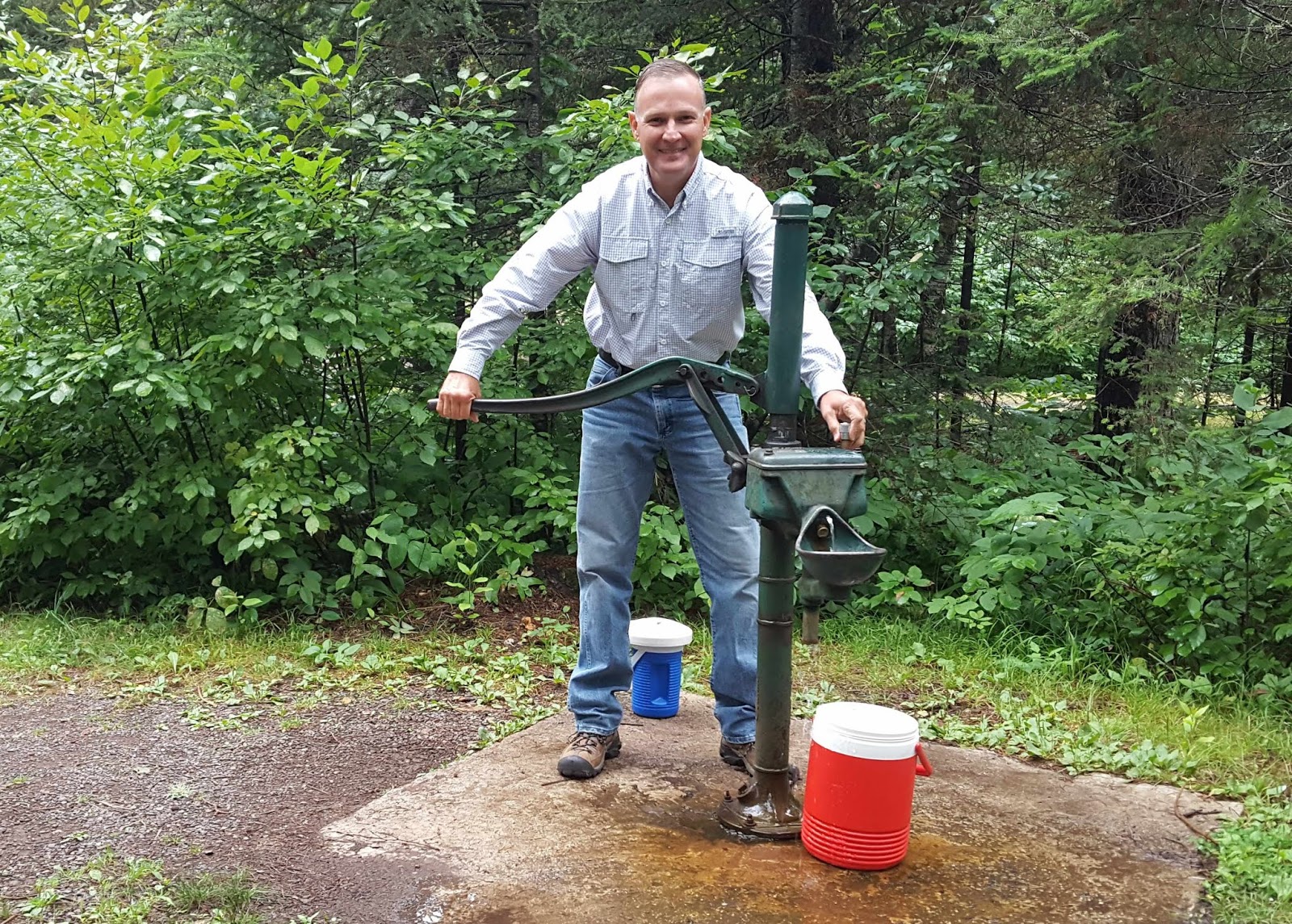
We have a great picnic area that backs onto a rock wall directly behind us. It's all lovely for $14 per night. We have no hookups, so we are still conserving water. We can use the campground water to fill our containers, but you really do have to pump the well.
We'll be running the generator to keep our batteries charged, but that's a good thing. Generators need to be "exercised," and it's been a while since we have been completely without electricity. Our only problem at this point, is whether we'll be able to get our motor home out of this site that we are wedged into.

The trip to get here was a winding road through the national and state forest. Denisa commented that this is the kind of road that would make most people car sick. But considering we are in a motor home, does that mean it's the kind of road that would make us home sick? (Sorry, but welcome to Mark's sense of humor.)
Once we were set up in the campground, we headed immediately for our first views of the North Shore of Lake Superior. Our first stop was Tettegouche State Park, and the Shovel Point Trail.

The trail takes us straight up on top of some of the highest stone cliffs of Lake Superior. If you look very carefully, you can see Denisa as a mint-colored dot among the trees on the edge of that stone cliff.

If we look the opposite direction, we can see the jagged rocky edges of the North Shore of the world's largest lake.

We're walking along the cliff edge, usually in the shade of the forest. The rocks and the trees must share the same space, and this set of trees has rooted around a boulder.

From our hike at the top of the cliffs, we walked all the way down to lake.

After seeing it from up high, it's now fun to see this greatest of the Great Lakes up close. We have totally wandered to another of God's wonders today!

We can now take a picture from the water level towards the colorful rock walls that ring the lake here. Mark is standing near the water level, touching his toes to the icy water of Lake Superior. With the average water temperature in the 40's, we're not tempted to go for a swim.

The lake water is perfectly clear, and we can see all the rocks that make up the lake bed. Mark loves climbing on the big rocks, and you can barely see him on the end of the little rocky peninsula in the middle of the picture.

What a beautiful day to get our first look at the water!

Instead of hunting for sea shells, people hunt for Superior agates here. We didn't find any, but the lake rocks are lovely straight out of the water.

We have been kayaking for the last couple weeks, and Denisa's ankle is finally healing enough to do some hiking. So we are heading out to more trails in Tettegouche State park. This trail led us down to where Baptism River flows into Lake Superior. Our campsite, seven miles away, is also situated on this river.

From here, we're headed up into the forest. For a short while, we were on the Superior Hiking Trail that runs for over 300 miles throughout the North Shore. Denisa's ankle isn't quite ready for that yet!

But she can make the 1.5-mile hike to High Falls. The ranger told us this was the tallest waterfall in the state.

To get a view from the other side, we crossed the swinging bridge over the Baptism River.

From this side we can see the placid river continuing down the valley after its high fall off High Falls.

We're still inside Tettegouche State Park. This is one of the biggest parks in Minnesota, and it has taken us from tall cliffs to rocky beaches to waterfalls in the forest.

We feel so blessed to be living in this neighborhood! After our orientation to Lake Superior, we have several more days planned to explore the North Shore. But for tonight, we're heading all the way home to Finland (State Forest Campground).
No comments:
Post a Comment