We're way behind in getting travel posts published because we were having way too much fun traveling! So we won't be confused about when each "wandering" happened, we'll start each blog with its actual date.
August 3, 2023
Our plan this morning was to kayak on Twin Lakes. But when we arrived at the lake, the wind and the white caps on the water convinced us that is was a better day to go for a hike. Should we go further down the road?.JPG)
Of course we should! So we left Twin Lakes and headed west on State Highway 82 towards Independence Pass. Signs at the beginning of the road warn that no vehicle over 35-feet long is allowed on this road because of the hairpin turns. We were in the pickup, so the turns were no problem as we gained elevation quickly. We could look down to see the highway beneath us as we zig-zagged up the Independence Highway..JPG)
The top of Independence Pass is at 12,095 feet in elevation. It's the highest paved road in Colorado, and it typically closes from November until Memorial Day because of the amount of snow at this high elevation. Denisa has an odd hobby of taking pictures of bathrooms in beautiful locations, and this one deserved a photo. The bathroom doors of the vault toilets were painted like a topographical map of the area, and looked out over a host of 14er peaks. Should we go further?.JPG)
We definitely should! We drove just a little further down highway 82 to a trail head that starts right along the road. Our new destination for the day was to hike to Independence Lake. We probably should have gotten started earlier, because afternoon storms were in the forecast. At 10:30 it was already cloudy, and the temperature was 54 degrees. We love hiking in the cool mountains in the summer!.JPG)

Two hundred yards across the mountain-side we saw the mother doe, now turning towards her babies.


.JPG)
as well as these burgundy blooms that were stunning. .JPG)
.JPG)
We arrived at our destination--Independence Lake--at noon..JPG)
Just past the lake was a high ridge that was calling our name. Should we go further and add the extra half-mile and steep elevation gain just to stand on that saddle and see the next lake?.JPG)
Well of course we should! We started up the steep grade and said good-bye to Independence Lake . . ..JPG)
and hello to Lost Man Lake. From the top of that saddle we got our first glimpse of the far lake that was surrounded by more mountains.
.JPG)
Because there are fewer hikers that continue to this lake, the marmots were out enjoying the views with us.
.JPG)
Then Denisa moseyed over to the rocks where the marmots were on alert. 


.JPG)
.JPG)
That's when we found out why the hikers were not looking at the lake. It was because they were looking at the mountain goats!

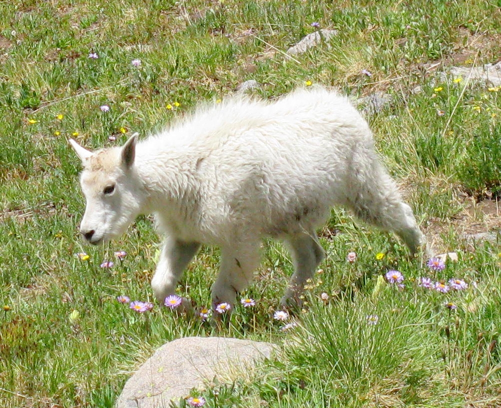


.JPG)


We even took pictures of Denisa taking pictures. You can see how close the mountain goats would approach us, as we never moved from our spot on the rocks..JPG)


Yep, this hike took a lot longer than planned with all these wildlife sightings! We still hadn't gotten rained on, and we were having a great time!.JPG)
Denisa has always speculated that Mark was part mountain goat. He hiked to the top of another ridge to take a picture of our surroundings in this magical place. (You might notice that Denisa was content to stay near the lake on her rock.).JPG)
Then he hiked to the top of the rocks to get a view of the valley beyond. Should we hike further over this ridge?.JPG)
.JPG)
This time we decided that it was time to turn around and head towards the pickup. The mountain goats were still hanging out close to the lake.

It was a great decision to extend our hike to Lost Man Lake, but now we had to tackle that steep hike up and out of the lake bowl.
.JPG)
We made it back to the saddle between the two lakes. Mark took a panorama picture that included Independence Lake on the left, Denisa in the middle, and Lost Man Lake on the right.
.JPG)
From there it was downhill all the way. We hiked past Independence Lake . . .
.JPG)
and enjoyed more of the wildflowers still blooming at 12,000 feet.
.JPG)
.JPG)
.JPG)
His ankle was hurting, but he had to make it back to the pickup. He was glad when we spotted the Independence Pass highway. In the picture below Mark was pointing to the highest paved road in Colorado, carved into the side of the mountain.
.JPG)
No comments:
Post a Comment