Canyonlands and Dead Horse Point Parks
Moab is a mecca of outdoor activity, and we are loving our time here. Besides Arches National Park, we found that Canyonlands National Park is around 30 miles from Moab. So we headed southwest early one morning, and arrived at Canyonlands before the visitor center even opened. The good news is that we get to visit another national park. But the bad news is that the jet stream has brought to Utah the smoke from the forest fires plaguing the northwestern United States. Our view into the canyon will be hazy today, but the layers of canyon walls are still interesting.
Canyonlands National Park is sliced into four districts by the Colorado and Green Rivers that run through it. Today we are at the most-visited "Island in the Sky" section. The ranger gave us best advice on how to attack this national park, and we followed his plan. First stop was the "Upheaval Dome." Scientists haven't determined if this giant hole was caused by a meteor or a salt dome collapse, but we determined it was huge.
We took the 1.8 mile hike to the best viewpoint of the upheaval. Along the way there were huge boulders to climb, and so (of course) Mark did just that. You can barely see him on top of the rock formation on the far left side of the picture.
This is a colorful national park. There is the Green River, the Orange Cliffs, the White Rim . . . We also found that the local lizards are colorful, having taken on the orange color of those cliffs.
Mark's hikes are usually longer than Denisa's hikes because he likes to climb on boulders. He always wants to see what's on the other side, or what's inside that crevice. So far he hasn't fallen off the other side or gotten bit from inhabitants of those crevices.
As we left this section of the park, we spotted a raven with a pine cone from a pinyon tree. We knew that there are pinyon nuts in these cones, and the raven was working hard to get them out. He would hold the green pine cone with his foot while hammering the hard nuts out of their shells with his beak.
The ranger's second destination is the "Grand View Point Overlook." It's a 2-mile hike along the canyon edge to get to the most southern tip of this great canyon. As we hiked on the east side of the point we could look down on the White Rim, a continuous sandstone bench 1,200 feet below. Another 1,000 below the White Rim is the Colorado River. This broad mesa is really an island in the sky.
The big boulders along the edge are fun to climb, and have an added bonus of danger since they could plunge into the canyon below at any time.
There are interesting shapes in the rock formations along the trail. What does that rock look like?
That is obviously a cowboy hat rock, and it just happens to be the perfect size.
We made it to the very tip of the Grand View Point, and this photo is proof. To the east we can see the Colorado River, and to the west is Green River. The confluence of the two rivers is in front of the Grand View Point. The smoke in the air made the canyon views of the Orange Cliffs hazy, but Mark and Denisa were pretty clear. This picture was taken by a Mother and daughter from Germany that were traveling all over the United States this summer. We have met so many foreign tourists in the national parks! Interesting note, they were from Oldenburg, Germany, the same town that Mark's ancestors are from. They were either too confused by our question, or perhaps ashamed to admit if they knew of any Engelmans still living in Oldenburg.
There was also a throne-like dead tree along the trail for another fun photo opportunity.
The third ranger suggestion was to take the half-mile hike to see the only arch in the park. So we made the short hike to see Mesa Arch. Noted for being a great place to see the LaSal Mountains, we could only see smoke in the air today.
A nice couple from Michigan offered to take our picture under the arch, so we got two pictures in one day!
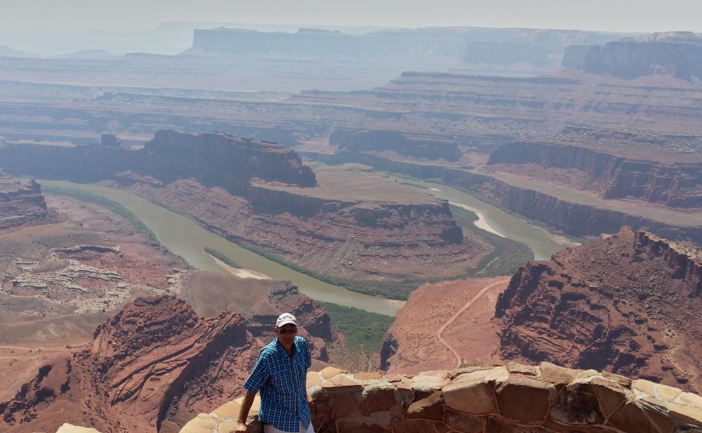
After seeing the highlights of Canyonlands National Park, we still had time to make the 10 mile trip over to Dead Horse Point State Park. The hike to the edge of the mesa gave great views 2000 feet below to the
Colorado River winding its way through the valley below. There was a
horse-shoe bend right in front of the view point.
The curious name for this park comes from the fact that cowboys used to herd wild mustangs to the end of this high mesa. They would build
a temporary fence across the 30-yard neck of the mesa and then choose the
best horses to keep. According to the legend, one time the culled horses
were just left in their temporary pen at the end of the mesa, where
they thirst to death.
Living close to Arches National Park makes us notice arches are every where. We spotted this huge arch that no one else even noticed.
Or maybe Mark just photo-shopped that picture of Denisa into that tiny arch under a small ledge. The actual size of the arch can be seen in the photo below.
One of the interesting sections of Dead Horse State Park can only be seen from afar. Those two squares of blue water in the distance below are actually giant evaporation pools. Potash is a salt found naturally in this area. A local company pumps water into the rock formation that holds the potash. This salty potash water is then pumped into the evaporation pools, where the sun will remove the water. The potash is then scraped out of the pool, and will be used as plant fertilizer. We're getting so smart from all this traveling we're doing!
We've learned something today. We've enjoyed some wildlife. We've hiked over six miles and got good exercise. We've seen some beautiful scenery. We've been a little goofy. But more important, we have wandered His wonders. It's a good day!


If you get a chance, go to Goblin State Park. You may remember seeing this on the news. A couple of "boy scout leaders" were video-taped knocking over one of the rock formations. It is a neat place to visit. There are also some slot canyons that are great for photo-ops.
ReplyDeleteBill and Paula