When we first arrived for our month-long stay in Angel Fire, New Mexico, we made a list of things we wanted to do. On that list was a hike to one of the prettiest little mountain lakes in New Mexico--Williams Lake. But the trail head is past the Taos Ski Village, an hour and a half drive from our campground. Would it really be worth driving that far for a hike? When we pulled into the trail head parking lot and could already see the mountain peaks around us, we knew the drive was worth it!
To get to that parking lot, we had to drive up Twining Road--a very steep gravel road that starts at the Taos Ski Village. But driving up that road brought us up to 10,200 feet in elevation and at the base of the Cachina ski lift. That's a good elevation to start a hike!
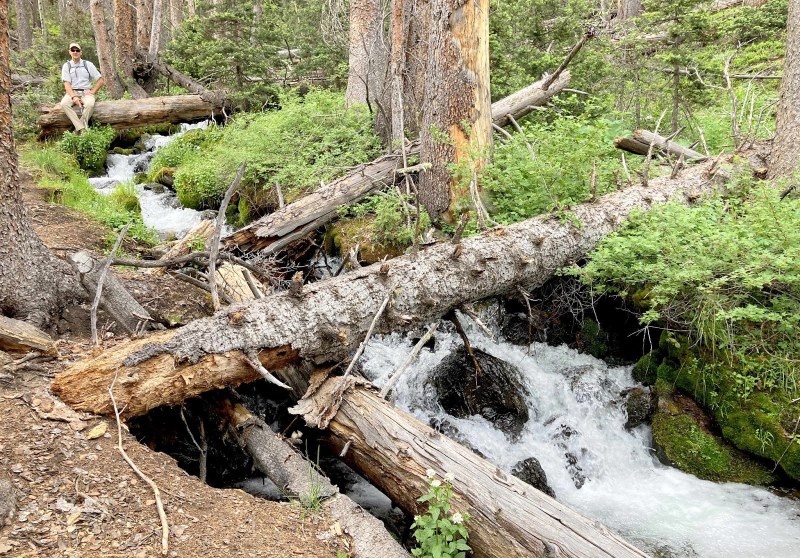
We were soon away from any evidence of the ski resort, and found ourselves walking beside a roaring mountain stream.
But then the work began. It's a rocky trail that climbs 800 feet in elevation during its 2.2 miles through the forest.
Occasionally we would break into an opening of a scree field, and get a quick view of the mountain peaks that were getting closer as we hiked higher.
You know it's going to be a "cool" hike, when you start seeing snow on the mountains that surround you.
We were greeted by a gray jay, whose friendliness made us think that he was used to getting trail snacks from hikers.
This smaller jay had less impressive plumage, but was better at posing for pictures.
Another quarter mile down into the valley, and we got our first look at Williams Lake.
This little alpine lake is worth more than just one look. We love to see the snow-speckled mountains reflected in the lake.
The signs says we are at the elevation of 11,040 feet overlooking the lake.
We think those craggly snowy peaks are the prettiest, but the star of the show here is the mountain that is pictured behind Denisa. That's the tallest peak in New Mexico--Mt. Wheeler. In just two more miles with another 2,000 feet gain in elevation, we could be sitting on top of that tallest peak today.
But we have plans for Wheeler Peak on another day. So instead, we're heading towards the pine tree forest in front of those snowy peaks instead.

That's because we've been told about a nice waterfall hidden in the trees. We'll always hike a steep slope up a mountain to see a nice waterfall.
Then we'll hike even further up that mountain to see an even bigger waterfall.
Then Mark will climb even higher up that mountain to get a bird's eye view of that big waterfall.
It's from that vantage point that he reported he had reached a beautiful plateau of snow, wildflowers, and babbling streams.
Denisa climbed even higher up the mountain because she is a sucker for snow,
wildflowers,
and babbling streams with wildflowers in the foreground! It was a beautiful place to be!
Mark likes a good hiking trail, but he loves even more to explore off the trail when the scenery is this beautiful!
The tips of those craggly mountains that were so far away when we first arrived at the lake, are now within our reach.
Scrambling up those rock slides is hard work, but Mark has to see the views from the next level up.
We have wandered into another of God's wonders, and we have this little piece of heaven all to ourselves. By now we have wandered several miles off the trail, and hiked up another 800 feet in elevation. We have also jumped over more than a dozen streams filled with snow melt and mountain spring water.
All this water makes for a spongy habitat that is perfect for the marsh marigold.
We are also far enough off the trail that we spotted our first wildlife of the day. This young buck is sprouting his velvety antlers, and he just stood and stared at us.
He finally decided to leave the meadow covered with the white marsh marigolds But we could tell that he still wasn't sure about the couple of wanderers that were obviously way off the normal trail.
If we were on the trail, we wouldn't have found this stream that disappeared into an ice cave . . .
or this peat moss meadow surrounded by mountain peaks that we just climbed from. The round trip hike to Williams Lake was supposed to be 4.4 miles. But with all our wanderings we turned it into a 8.3 mile round trip. Our day of fun exploring was definitely worth the drive we made to get here this morning!
For hiking that kind of distance, we could have made it to the top of Wheeler Peak and back. But instead, we enjoyed our wanderings in the forest around one of the prettiest mountains lakes in New Mexico. After we tramped back to Williams Lake we took another look at the highest peak in New Mexico. We won't come from this direction, but we'll be at the peak of Wheeler Mountain very soon!
Since we've been hanging out in Angel Fire for several weeks, we have made the trip over Bobcat Pass several times. It's the high point between here and Red River, and it's a steady climb to the pass summit at 9,820 feet. That's the highest mountain pass in the state of New Mexico.
Just past Bobcat pass, we've noticed the sign for something called "The Enchanted Forest." Well that certainly sounds like fun! So we followed the signs to find the office of the "Enchanted Forest Cross Country Skiing and Snowshoeing." During the winter months, they rent equipment and charge a fee to use the trails cut through this section of the Carson National Forest.
But during the summer, these trails are free and open to hikers.
So we took off on the Sasquatch Trail that started at the base of the Enchanted Forest. Do you notice any similarities in the stance?
We also went on trails with names like "Sherwood Forest." After seeing a pile of bear scat, we needed to make some noise so we didn't surprise any bears in the forest. So we thought it was appropriate to sing a song from the Disney Robin Hood movie when hiking through the Sherwood Forest. We didn't see any other hikers this day, or they probably would have giggled at two old wanderers belting out lyrics like, "Robin Hood and Little John walking through the forest, Laughing back and forth at what the other 'ne had to say . . ."
As we sang, we figured out that the snowshoe trails are marked with brightly-colored tape on the trees. These narrow trails wind through grassy areas in the forest.
On the other hand, the cross-country ski trails are wider and follow the dirt roads that snake through these forests.
We discovered that we preferred the snow shoe trails because they were less dusty, and they took us to the edge of our mountain for some great views around us. We have been in this area long enough that we now recognize some of the mountains that we see. That's Gold Hill on the right where we hiked last week. On the far left we can see the ribbon of road that is Highway 578, where we will begin our hike next week into the Mount Wheeler Wilderness.
On the other side of today's mountain hike, we can look straight down into the Main Street of Red River, New Mexico.
Maybe it was because we were singing, but we didn't see any wildlife on this hike. But we always seem to find a new-to-us wildflower. We think this is a purple penstemon. The flowers stand so still and don't care when you are close, so they are much easier to photograph than wildlife anyway.
For the winter skiers and snowshoers, there are warming huts strategically located at junctions of trails. With temperatures in the 70s today, we don't need to be warmed. We are finding these temperatures to be just right!
We also hiked around several yurts that are available for rent here in the Enchanted Forest.
We peeked inside this unoccupied yurt to see that it looked quite comfortable.
Some of the trails dead end at the outskirts of the Enchanted Forest. Instead of walking back up the same trail, Mark loves to bushwhack his way through the forest. We're climbing over downed logs and running into natural road blocks like we have so many times before. Mark thrives on this kind of meandering through the woods! We've done this many times before. That reminds us of the second line of that song from the Robin Hood movie, "Reminiscin' this-'n'-thatting, Having such a good time, Oo-De-Lally, Oo-De-Lally, Golly what a day!"
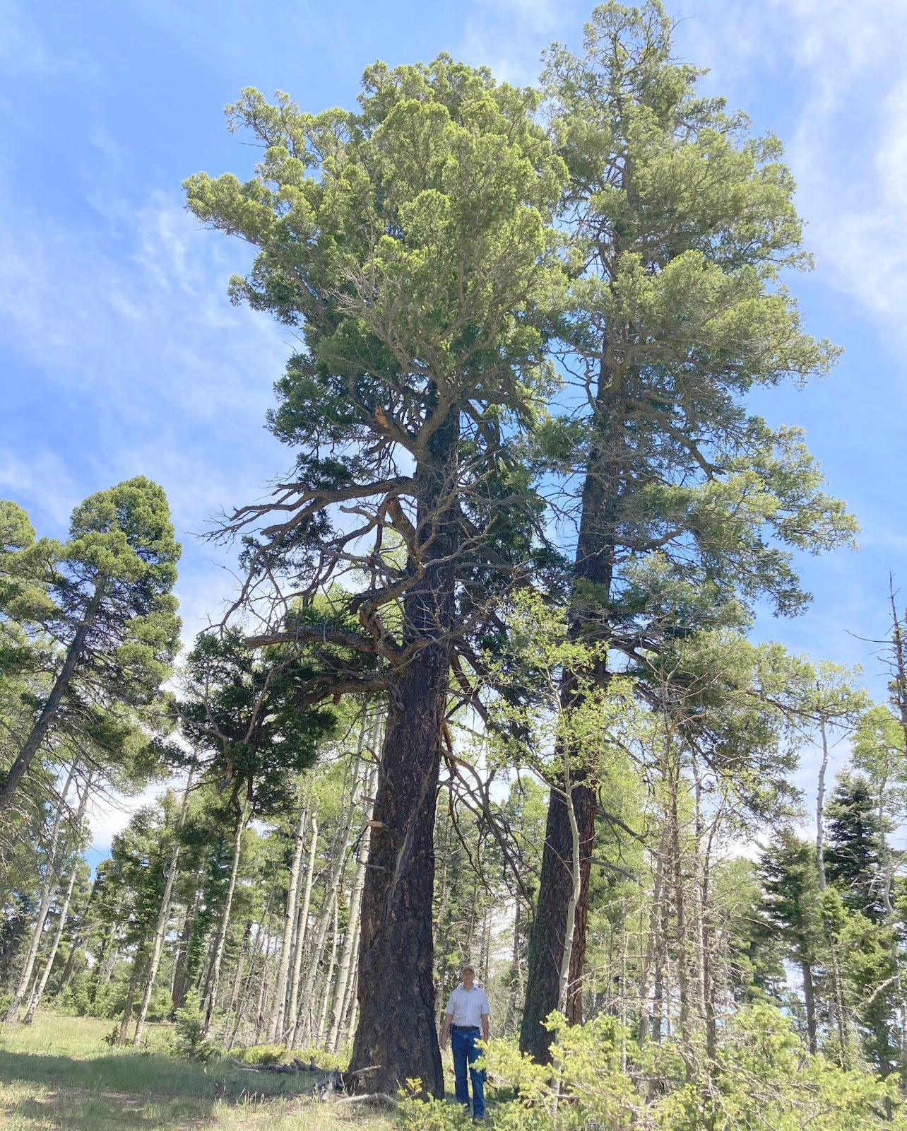
It is a beautiful day, and we have wandered into more of God's wonders with this hike. We love these big old pines,
and the lovely groves of aspen trees, as we continue to sing that song.
We were trying not to sweat too much as we wandered up and down a 7-mile loop through the forest. That's because we were meeting friends for a special evening just a mile down the road here on Bobcat Pass. They are treating us to a "Cowboy Evening."
After taking the obligatory photos behind the picture boards, we met Brent and Melinda at the open-sided tent for an outdoor feast.
The cowboy chefs are cooking up the rib-eye steaks, baked potatoes, corn-on-the-cob, brown beans, and chuckwagon biscuits for us to savor. They normally feed 300 each night, but because of social distancing rules, they cooked a mere 181 steaks tonight.
The meal was trumped with a cinnamon roll that has become legendary in this part of the country.
While we groaned with delight from our over-filled stomachs, we were then entertained by cowboy music from the stage. It was toe-tapping music, and a couple of wanderers found a way to two-step on that uneven saw-dust strewn ground.
It was such a fun Cowboy Evening, and we appreciate the invitation from our friends Brent and Melinda! Like we've been humming all day, "Oo-De-Lally, Oo-De-Lally, Golly what a day!"
We love the view of mountain peaks peeking through the miles of forest, and today we are going to see lots of those peaks. We are looking forward to a special day of hiking, thanks to the planning of a special friend.
Brent and Melinda used to ranch in Oklahoma, but now they are residents of Red River, New Mexico. Brent volunteers as a hike-leader for locals and tourists through the Community House. But since all the free Community House events are cancelled for the summer because of the coronavirus, Brent is volunteering to be our personal hike leader for this hike. We are so lucky! He has planned a 12-mile U-shaped hike that will be possible because he has two rugged vehicles. We are driving their 4-wheel-drive pickup, following their Can-Am ATV that you can see in the road ahead of us in the dust. We are traveling the scenic Forest Road 597 that traverses the high mountain roads north of Red River.
As we drive, we are actually looking down on the ski resort trails in the village of Red River. What a view!
Both vehicles went up the very rugged road to Cabresto Lake. We had thought about bringing our car to the lake, but when we saw the steep rutted road, we saw what a silly thought that was. No way could a passenger car make it up that last two miles! We got a sneak peek of the lake while we paused long enough to leave the four-wheel-drive pickup here in the parking lot. This will be the end of our hike later today.
Then we drove the Can-Am on to our trail head eleven miles away. This is a little known trail that only locals like Brent know about, and we started hiking on it at 10:30 a.m. Even though we are starting this hike at around 10,000 feet in elevation, we immediately headed higher up into the forest.
We had a beautiful blue-sky day, but we have to say the air up here is super thin. We needed lots of breaks to sit and breathe, and this crooked aspen provided a comfortable place for that.
It's up here in this thin air that the seldom-seen bristle cone pines thrive. These trees can grow to be more than a thousand years old. We learned that the best way to identify a bristle cone is to carefully examine the bristles. If it looks like it would make a good baby bottle brush, it is a bristle cone pine.
About the time Denisa's stomach starting growling, we broke out above tree line for some great views of the surrounding mountain peaks. We like to take pictures of some of the loveliest lunch views on this planet that we get to enjoy.
We have hiked all over North America, so we know our way around a trail or two. We usually use an app called "AllTrails" that rates and reviews hikes. Even though that app has reviews of over 100,000 different trails, it doesn't know about this one. Thanks to Brent for taking us where few people have hiked before! We have now crossed into the Latir Wilderness, where some wild animal seems to be eating this little-seen sign.
In all our miles of hiking, we have never seen a "bearing tree." Used as a survey instrument, it marks the corner of a property from the measurements taken in 1966.
We've been on the trail for almost 4 hours so far, hiking up-hill most of the time. Once we are above the trees, Brent takes us off the trail for the final push to get to our first destination of the day--
the top of Mount Baldy! The summit was marked by this curious stack of rocks and sticks. Considering that Mount Baldy is bald of rocks and trees, this summit cairn is actually more impressive than we first thought. Someone had to carry those rocks and sticks from some distance to make that marker.
Inside that stack of rocks is a metal can with paper and pencil needed to register that we made it to the summit. We penciled in the date and registered, "Mark and Denisa and our trail guide and friend Brent. Beautiful views!!!"
These are the beautiful views that we were enjoying from the top. In the picture we can see Bear Lake--the tiny emerald oval that is far below.
This is our first view of snow on this trail, so Denisa has to scramble down the steep mountain side to enjoy having her feet in snow in the middle of summer.
It was windy at the top, so sitting just over the rim of the mountain gave a windless comfortable place with a great view.
After enjoying a little peak time, we were on the trail again. But now everything is down hill!
Without our local trail guide, we might have been duped into hiking along the trail to this official trail marker--with a lower elevation in the trees and without the glorious rim views.
As we continue down the mountain, we are once again in the trees. We stumbled onto this U.S. Forest Service cabin in the woods. We sat for a few minutes by the cabin,
but we are soon on the trail again to our next destination--Heart Lake.
We really expected it to be shaped like a heart, but a more accurate name would be "tear drop lake."
We had to stop for breathing breaks on the way up the mountain, but we can hike for miles at a time when it is downhill like this second half of the trail. We did take a break at Bull Creek, to enjoy the sounds of the rushing water . . .
and the pretty little mountain blue bells--also known as chiming bells.
As we continued on this 12.2 mile hike, we entered a section of forest that was filled with moths. It's hard to take a good picture that illustrates the hundreds of these gray moths in the air. Even though all those white specks make it look like it was snowing, it was actually "mothing."
At around 6 p.m., we arrived at our final destination--Cabresto Lake. We started hiking at 10,000 feet in elevation, made it to Baldy summit at just over 12,000 feet, and now we're back down to a little over 9,000. It's been a slow roller coaster of a ride today.
We can't lie, we were glad to see this man-made lake that marked the end of this 12.2 mile hike. We stopped just long enough to take a few pictures, then we were glad to sit down for the ride back to our starting point where we left the other vehicle.
We left the motor home at 7 a.m. this morning, and after a stop for pizza for supper, we got home after 9 p.m. It was a full day of wandering God's wonders in these beautiful mountains! This was such a great opportunity to see some of the best of the New Mexico mountain scenery! We love a loop hike, and this was even better. We were so privileged to have a private guide and friend to give so much of his time and resources to make this special hiking day possible! People that give so much to make special experiences for others are another of God's wonders!