We were up early this morning. We learned our lesson that it is important to beat the heat at Arches National Park, so we rolled past the entry gate before 7:00 this morning. The sun was just peeking over the horizon as we drove by some of the large red rock formations that we have come to love.
Thursday, September 30, 2021
The Early Morning Arch Tour at Arches National Park
In the distance, we can see the first light of the day coming through the arches. Even though we had pretty thoroughly visited this national park six years ago, we just couldn't leave without seeing some of those arches again.
So we started our early morning arch tour at the Windows Section of the park. The windows are open this morning!
Our first arch of the day is lit up by that early morning sunshine. Denisa climbed through the window so Mark snapped this picture of Turret Arch.
As we walked toward the next set of arches, we were looking into the sun. Denisa climbed up into this window, but this picture wasn't snapped by Mark. Another early morning riser took this photo with the bright sun behind Denisa and thought it was nice. So she approached us and offered to air drop it to our phone. Nice!
This is a matching set of arches, so we took this picture of Denisa in the north window . . .
and Mark in the south arch.
Together they make up the North and South Arch. We have wandered into more of God's wonders!
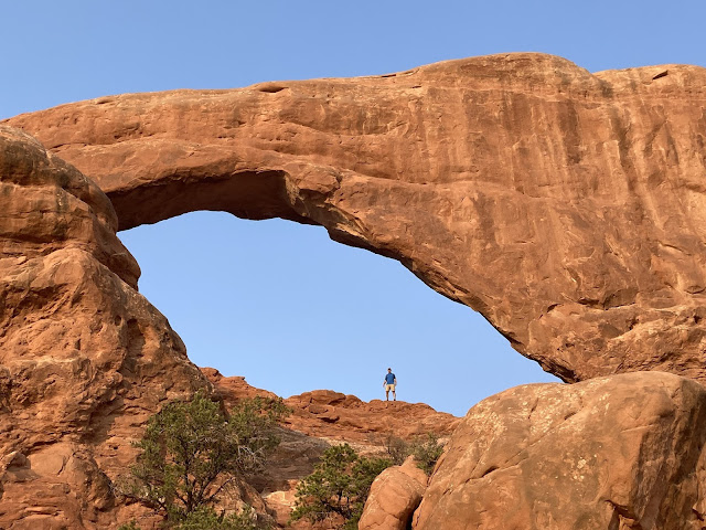
Arches National Park has the densest concentration of natural stone arches in the world, and more people are discovering it. The number of people visiting has almost doubled in the last 10 years, causing park closures when the parking lots fill and the maximum occupancy is exceeded. That usually happens in September, when temperatures start to cool. Definitely the way to beat the heat and the crowds is to come early or late in the day. The crowds are still quite small and it is still quite cool this morning. So we made the short hike over to the Double Arch to continue our arch tour. Can you see Mark's silhouette inside the arch?
You can get all kinds of neat pictures of the Double Arch, and of course we tried lots of angles.
Then Mark took a picture of Denisa looking quite small on the desert floor during this arch tour.
Denisa walked all the way around this massive rock formation just to get a picture of the backside of Double Arch. We have definitely wandered into more of God's wonders today!
That put us on the way to another feature seldom mentioned in the arch tour. We are heading towards Cove Arch. It's hard to see in the middle of the picture below.
It's not listed in the national park brochure, and there is no trail leading to it. But we hiked to where we could see the blue sky through Cove Arch.
Mark has met few arches that he couldn't climb into, so he finally found a way to get in the window.
It's fun to see the camera view, framed by Cove Arch, of this desert-like national park.
Walking back to the pickup, we saw Elephant Butte. If you squint year eyes, you can see the head and trunk on the right, and the elephant's body on the left.
Denisa is getting nosed by that elephant trunk as we headed back to the air-conditioner in the pickup. It's now 9:30, and the temperature is heating up as we finished our early morning arch tour here at Arches National Park. While most of the day's visitors are just coming into the park, we're glad that we have toured and are already going out.
Our arch tour today included six arches. That's a few less than the 2,000 documented arches in this national park. But it was a great morning of wandering through six more of God's wonders!
Tuesday, September 28, 2021
Crazy at Canyonlands National Park
Staying in Moab, Utah, allows visitors to explore Arches National Park. But we got a two-for-one deal when we made the short drive to Canyonlands National Park as well. Canyonlands is actually divided into four different sections. The most-visited is the "Island in the Sky" section, and that's a 32-mile smooth highway drive from Moab. Our return drive is NOT a smooth highway drive, but that's another crazy story. On the way to Canyonlands, we passed through interesting scenery that included these two buttes--Monitor and Merrimac--named after two Civil War ironclad ships. It looks like two big ships approaching each other in a sea of sand in the distance.
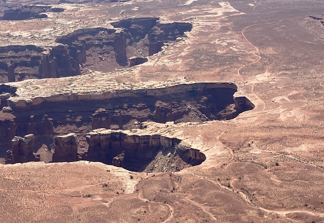
Once we checked into the Canyonlands Visitor Center and got our best advice from the ranger, we continued into the national park to the Grand View Point Overlook. This is where the two canyons--carved by the Green and Colorado rivers--meet.
Standing on the ledge high above, we got grand views of the two canyons and the buttes far below us.
We also got a view of the road at the bottom of the canyon. You can barely see the winding squiggle of a dirt road that follows the edge of the canyon ledges far below us. We caught sight of some crazy people, driving a jeep slowly maneuvering this rugged terrain. But it is so far below us that the jeep and its crazy occupants didn't show up in the picture.
We headed on to another viewpoint, that showcases one of the few arches in Canyonlands.
After getting the obligatory picture in front of the Mesa Arch, we took one through the arch. Again, we can see that ornate canyon far below us. Are we crazy, or is it calling out for us to come and play?
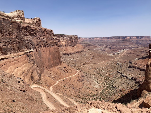
Our next stop is Shafer Canyon Overlook. That provides another beautiful view of the canyon, and now we see the road that winds into the canyon more clearly. We can see a couple dots below, which are vehicles full of crazy people driving into the canyon.
Actually, from that viewpoint we can see the crazy road that leads from the top of this national park, all the way to the bottom.
From our vantage point at the top, we could see the jeeps on the upper parts of the road, and the crazy steep drop-off beside the edge of the road.
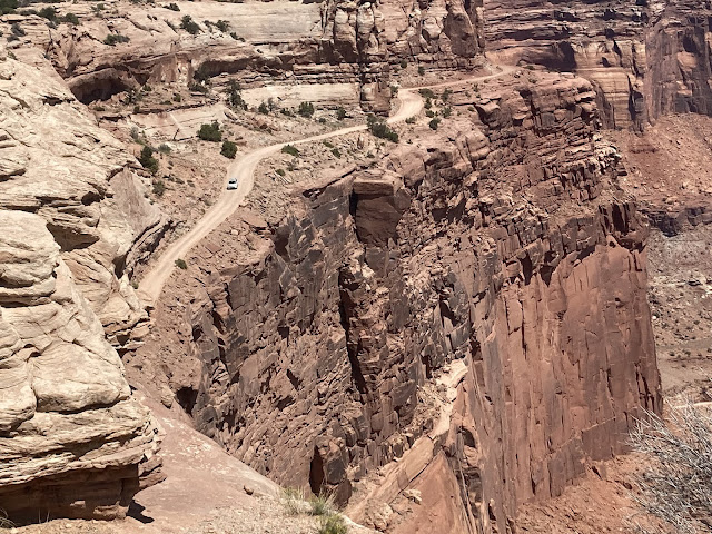
Here's a zoomed-in picture of the red jeep we followed down. He would be our Australian travel buddy, as we talked to him on a couple rest stops.
The road looks crazy from the top, and perhaps even more crazy when you are driving it and seeing the tight switchbacks that are ahead.
This one-lane dirt road is called the Shafer Trail. The sign at the top explains that it is recommended that only high clearance 4-wheel drives take this trail. From here it is a 45-mile trip back to Moab. It is used by vehicles going both down or back up from Shafer Canyon, but you an see that meeting a vehicle going the opposite direction can be very challenging.
You must be crazy to drive the road, and even crazier to sit in the passenger seat taking pictures down the canyon.
The hair-pin turns are the tightest ever, and the consequences for not steering through them properly are crazy! As we were going down, meeting a vehicle coming up takes special planning as there are few place wide enough for two cars.
So we were shocked to meet a walker coming up! We didn't have an opportunity to ask questions, but we would have loved to know the story behind this hiker.
Once we got to the bottom of the canyon, our winding road became a straight ribbon of dirt road that continued through the canyon. To drive through the national park, vehicles must have one of the limited-number permits from the visitor center. With that permit they would take a right-hand turn at this point and continue into the area we were looking down on from the Grand View Overlook.
But we didn't have a permit. So we are traveling on the straighter Potash Road that eventually heads back towards the town of Moab. The scenery at the bottom of this canyon is beautiful!
The rock formations that we saw from the top are now right in front of us.
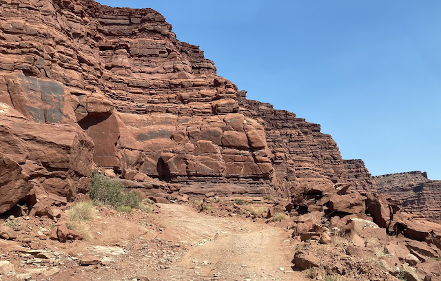
As we got further down the road, it got bumpier. Now we understand why you must have a four-wheel-drive to traverse this road.
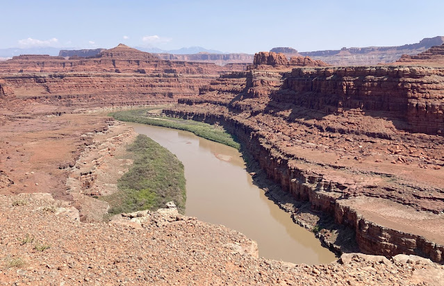
This road eventually took us all the way down to the Colorado River that formed this canyon.
The river makes a sharp bow for a nice panorama picture at the bottom.
This is where one of the scenes from the movie "Thelma and Louise" was filmed. Imagine a car flying through the air off the side of the canyon in the picture below. This just proves that we are driving where crazy Hollywood once drove.
We kept stopping to look around and take pictures here in the bottom of the canyon with its beautiful rock formations.
Our plan was to drive this road all the way back to Moab. But that's still 38 miles away, and the road has seriously disintegrated. We're not sure if it is passable all the way, so we are glad to see a couple jeeps coming from the opposite direction. We're not sure if we should trust the advice from this mud-splattered high clearance crazy vehicle.
The GPS says we're only 34 miles away from Moab at this point, but it's also estimating that will take 1 hour and 31 minutes. That's assuming we can cruise this dirt road at 20 miles per hour. That would be a crazy fast speed on this road.
We're questioning our decision to drive Potash Road at this point. This is a crazy adventure!
We finally made it to the section of this road owned by the Moab Salt Company. Signs let us know that they allow public use of the road, but ask you not to get out of your car. Across the fence line we can see the colorful salt evaporation pools.
These pools are using the hot desert sun to evaporate the water and leave the salt behind.
The road through this section continued to be rough. We both decided that we wouldn't have made this drive if we would have started from the Moab end of Potash Road and saw how bad it was quickly. It did have interesting scenery, but it was a long and tedious drive.
We were relieved when we finally got back to pavement! Our drive had certainly taken longer than we thought it would, and we wouldn't recommend it to others. We must have been crazy to try it!
We were only a few miles from Moab when we saw several cars parked beside the road. Like we usually do, we parked too. We always assume there must be something worthwhile to see if so many people are looking up at these big red rocks beside the road. We quickly saw it for ourselves--prehistoric Native American rock art.
After our art stop along the road, we continued through the town of Moab. It has changed from the sleepy little town we remembered from six years ago. Below is a picture of one of several brand new hotels that are springing up close to Arches National Park. We can tell that tourism has certainly caused this little town to grow into a touristy mecca for adventure-seekers.
It has been a crazy day at Canyonlands National Park. Even though we wouldn't recommend our drive on Potash Road to visit this national park, we would still recommend a visit VIA THE HIGHWAY ROUTE--unless you're crazy.
Subscribe to:
Posts (Atom)


