During our five-day stay in Ouray, we walked through town, and drove the streets to get to know our new home town better. But on our final day, we got some epic views from ABOVE this little village. The town of Ouray has a 7-mile perimeter trail that heads straight up into the mountains that surround it.
Those steps got us up on mountain ledges, for a birds-eye view of the town of Ouray. We also got a better view of the mountain on the right. That's the one we see when we look straight up above our motor home.
In fact, if we zoom in at the bottom of that mountain, we can see our RV park at its base, as well as the edge of the Ouray hot springs pool.
We are literally hiking along a ledge of the mountain, with the solid rock wall on one side and great mountain views on the other.
We think it is interesting that the mountains that surround this little village are all unique. Some are red, some gray, some are covered with trees, some are tree-less. We are seeing more of God's wonders from our new height!
We are traversing around a mountain on that ledge, and that same ledge took us right up to Cascade Falls.
That's when Denisa took her cue to walk the trail down to the base of the falls, to take pictures of Mark. You can see him enjoying the view from the left side of the waterfall.
He made his way right up to the edge of the waterfall for a nice shower.
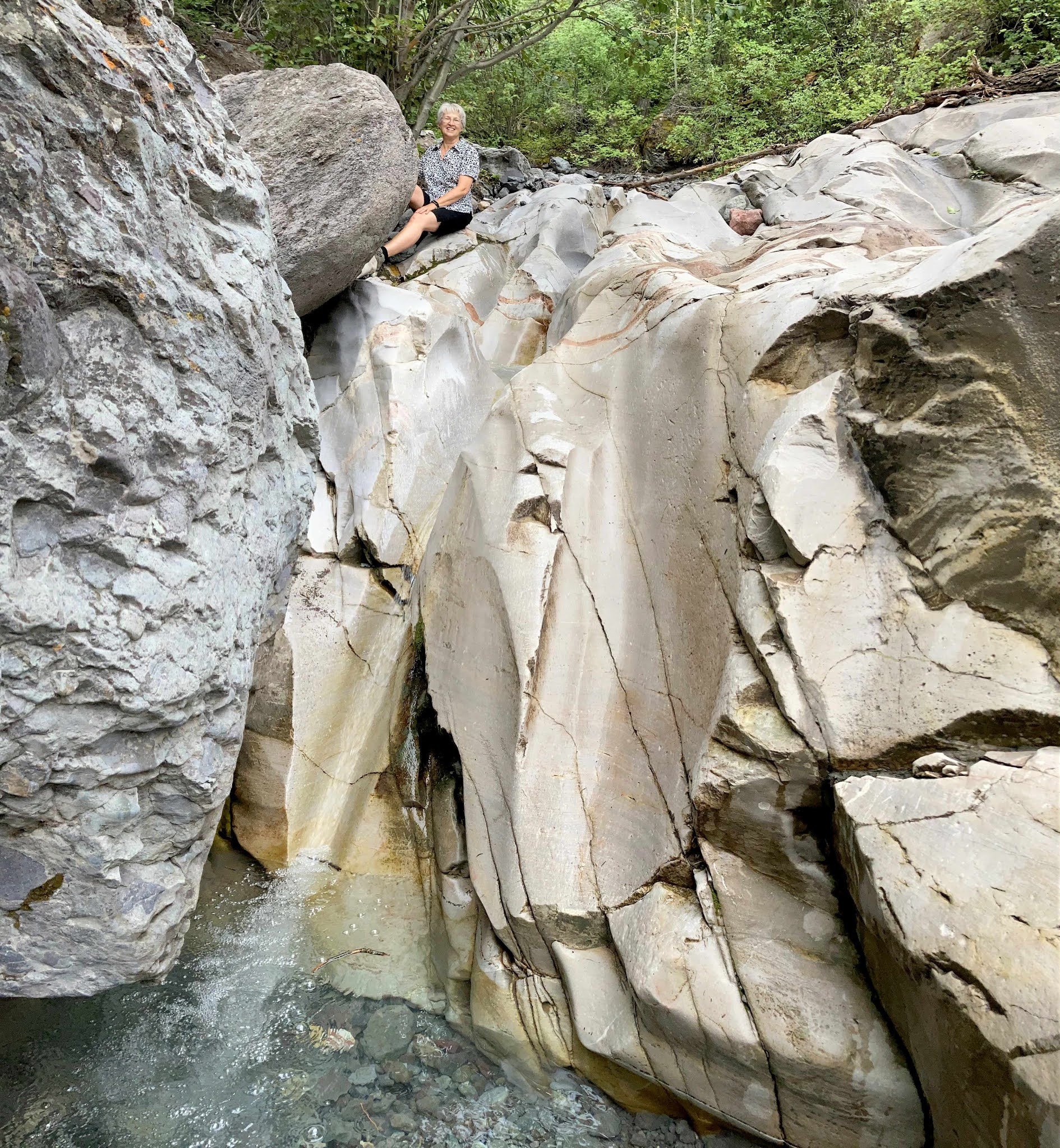
After the waterfall, we spent some time hiking in the trees until we popped out of the forest on the south end of town. The next point of interest is something called the "baby bathtubs."
Years of running water has carved basins in this slick rock. Legend has it that Indian mothers bathed their little papooses in these baby-sized basins.
Hopefully they held onto those sweet little babies because the baby bathtubs become baby slipper slides with a big drop-off right after the basins.
Our next stop is the high point of the trail--not because it is the most exciting point--but because it is literally the highest in elevation. 
We actually hiked this part of the trail five years ago, and it's about here that we got caught in a torrential rain storm that day. But in this summer of drought, we have blue skies as we continued our hike.
From the highest point, we headed downhill sharply. When we found ourselves among lovely green ferns and white-barked aspens, we thought that was as pretty as a picture. That's also when Mark looked down and found a snake at his feet. His reaction was much calmer than Denisa's, and she was thirty feet away from the snake.
These mountains are filled with minerals that can turn the water a strange color. This creek bed was filled with bright yellow water and white rocks as we crossed a bridge on the perimeter trail.
The perimeter trail follows a big water pipe for close to a mile. We really wanted to know what color the water inside that pipe is.
We hiked by this sheer rock wall that is part of the new Via Ferrata. That is Italian for "iron path," and that term is used all over the world for a protected climbing route that often uses the help of iron hand and foot holds to traverse difficult mountain paths. This Via Ferrata was just completed in Spring 2020, and it is a rock-climbing route along the Uncompahgre River above Ouray. If we look closer at the base of that rock wall . . .
we can see the helmeted climbers making their way across the rocks far below us.
Our next stop on the perimeter trail is the bridge over Box Canyon. From the metal bridge, Mark has a birds-eye view of the town of Ouray . . .
and straight down to the river very far below us.
For a fee, hikers can explore the waterfall inside the canyon, but we opted to continue our hike through the dark tunnel,
and down the many steps that continued us on the perimeter trail.
Did we mention that there are MANY steps going up and down on this trail?
We had totally under-estimated this perimeter trail, and we're getting tired as we make the next turn for more views over our little village. We exchanged picture-taking duties with a group of guys we met earlier this morning.
After a turn and then back up the hill, we were at eye-level with the famous Box Canon sign that can be seen from all over Ouray. It's been up on that mountain since 1909, with its six-foot-tall letters that are lit up at night. Some people have thought it was misspelled, but it is the Spanish spelling of the word "canyon." In 1909 they forgot to include the Spanish tilde (~) over the first "n" to make it grammatically correct.
We have the Italian "Via Ferrata," and Spanish "Box Canon," and we should also add that Ouray is called the "Switzerland of America" for its setting in this narrow mountain-circled valley. This 7-mile hike has become an international journey. We thought we were about finished with this hike, and our water was running low, but we're still so high on the mountain that we can't even see Ouray at this point.
We are glad to report that we did make it down off that mountain, with just enough water left to wet our whistle as we walked back to the motor home. That was a long hike to take right from our doorstep without even moving the car today! We under-estimated all the elevation gain as we went up and down the mountains around the little village of Ouray.
Did you spot the time when Mark and Denisa were "quick change artists"? If not, scroll back up to the baby bath tubs and notice that we suddenly changed clothes for that small section of the hike. We actually walked that part of the trail a couple days before, obviously wearing different clothes. We're just trying to keep you on your toes, with new things to spot while we talk about our wanderings!


No comments:
Post a Comment