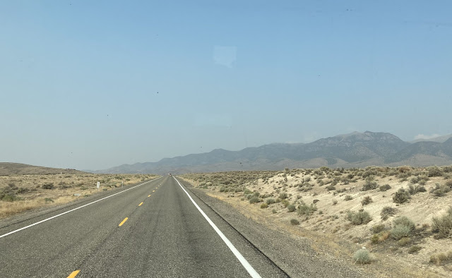
In 1986, Life Magazine wrote an article about Route 50 that runs east and west through the state of Nevada. It called this 408-mile stretch of highway "The Loneliest Road," and the name stuck. As we are fleeing the smoke from the wildfires in California, we are driving straight east across the state of Nevada on the loneliest road in the United States.
After leaving Reno, Nevada, we didn't feel lonely because we saw plenty of traffic and houses for the first 45 miles. At Fallen, Nevada, we wanted to fill up with diesel because we had read that the opportunities for fuel are limited down this road. The first station in Fallen was out of diesel, at the second station the pump wasn't working, and the third station's pump tried to eat our credit card. We had a tough time filling up the motor home and the pickup, but we finally got full tanks in both. As a side note, we thought it was interesting that this town spells its Main Street like the state of Maine.
Outside of Fallen, Nevada, we began to feel lonely. Barren white fields called sand flats surrounded us as far as we could see.
We began noticing that people had used this white surface as a tablet to write their names. Jessy and Darcy had to bring their own rocks, as this area is devoid of anything but crusty white earth.
The number of names picked up as we got to a white sand flat section that even provided the little dark pebbles a short walk away. Some used this tablet to write a more purposeful message. We felt less lonely as we started to read the preamble to the U.S. Constitution, "WE THE PEOPLE OF THE UNITED STATES, IN ORDER TO FORM A . . .
MORE PERFECT UNION, ESTABLISH JUSTICE . . . The preamble went on for miles, and we applaud the project!
It's interesting that these miles of perfectly flat valleys are punctuated by occasional hilly sections where the loneliest road curved as we gained elevation.
Out of the hills, we came back to miles of flat dry lake beds. That is a very lonely sight to see--miles where even the water is gone.
This road runs parallel with the route that the pony express took across this desert. There are a couple pony express station markers, but we didn't stop today because we were intent on getting out of the smoke.
Many of these lonely miles are open range area for cattle. We didn't see any cattle, as there doesn't appear to be anything for them to eat. We enjoyed the signs that alert travelers to the possibility of cattle on the road. According to the image on the yellow signs, the cattle on the loneliest road appear to be hold outs from some Mexican bull fight.
This is an easy drive, with almost no traffic and mostly straight roads. Denisa is getting bored, and is doing a little research on the number of cars we meet on the loneliest highway. They have mile markers on the side of the road. Denisa tallied that we met five cars between mile markers 100 and 110, and four cars in another ten-mile count. That's pretty lonely.
We saw our first hint of blue sky and clouds about 100 miles down the road. It was nice to be able to see the surrounding distant hills, instead of faint outlines of mountains like we saw at the beginning of our drive.
The drives through the valleys were flat and straight and allowed for 70 mile per hour speed limits, Then periodically we would wind up another pass, with 30 mile per hour limits. First was New Pass at 6,348 feet, then Mount Airy at 6,600 feet.
When Denisa would take a picture, Mark would ask, "What is in that picture?" Denisa would reply, "Nothing." There's a lot of nothing to photograph along the loneliest road. Since we were trying to put some miles between us and the wildfires, this was actually the perfect time to travel this road. We didn't feel like we sped by anything important in our quest to get out of the smoke.
After 111 miles, we arrived in our first town with a population of 161. You've got to love the tiny village of Austin, Nevada, with two church steeples visible as we made our way through town.
Our destination is just a few miles further as we gained elevation again. We are headed to Bob Scott Campground, situated on the crest of the next mountain pass. But after we climbed that winding highway, we found that all the camp sites were already full this evening.
That's fine, because we knew about the big pullout right across the highway. It's actually much easier for big rigs to pull into and get level here, rather than the U.S. Forest Service camp sites. We pulled in next to the Nevada state information sign, and saved the $10 camping fee charged at the no-hook-up campground.
The thing we liked the very best about our camping spot is the view of blue skies and white clouds! We have finally driven far enough to get out of the smoke. We opened all the windows and breathed in that fresh mountain air! That's something we haven't gotten to do for the last week. We slept well with cool temperatures and almost no traffic, in the middle of our trek across the state of Nevada on this loneliest road in the United States.


No comments:
Post a Comment