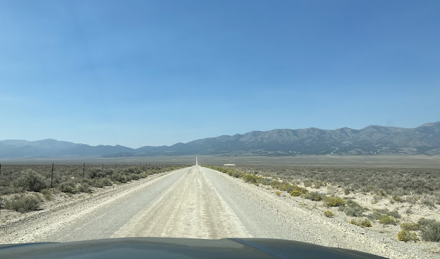
Yesterday we drove half-way across Nevada on Highway 50 - known as The Loneliest Road in the United States. We had a good night's sleep in our free camping spot along the highway. We didn't see much traffic during the day, so the traffic noise was zero during the night. We are at 7,200 feet in elevation, so it was pleasantly cool for sleeping. Even though the skies were clear when we went to bed, some smoke had arrived on the loneliest road by morning.
On our second day of traveling such a lonely highway, we realize that we have seen few roads that intersect with it. They do have large yellow signs that announce what looks like an impressive intersection. Then you find out that it leads to places like Grimes Ranch or Willow Creek Ranch. As we go by, we see that this big intersection turns into a dirt road that leads to a cattle guard or a closed barbed wire gate.
After driving through Eureka, we noticed a pasture filled with white boulders on the hillside.
When we got closer, we realized the boulders were actually sheep. While we saw the sheep dog and the shepherd's saddled horse, we never saw the shepherd.
There is a sea of sagebrush as far as you can see in all directions on most of the loneliest road.
At one time this section of Nevada was filled with miners and mine camps. Now we see only the remnants of some huge mining operations that left the mountain in curious striped patterns.
Mining has been replaced with gambling. As we drove into the little town of Ely, we wish we would have counted the number of casinos in this tiny town. Just within these two blocks we saw Jailhouse Motel Casino, Hotel Nevada Gambling Hall, and Mr. G's Casino. Slot machines are in convenience stores and gas stations and restaurants in Nevada.
We haven't seen any wildlife along the loneliest road, even though some signs warned us that elk might be on the road. We stopped in at the elk viewing area, but they were spending their summer vacation in the mountains.
We left the motor home parked at the elk viewing area, so we could drive the pickup on our only side trip. We are headed down a gravel road towards the Charcoal Ovens State Historic Site.
These six brick ovens were built in 1876 to turn the native trees into charcoal.
Each oven is 30 feet high, and 27 feet in diameter. Today we can walk inside, but they were designed to hold large amounts of wood. It took 6 acres of the native pinyon and juniper trees to fill one oven all the way to the top. Then they were started on fire and allowed to burn for twelve days.
These six structures were only used as charcoal ovens for three years. By then, they had cleared all the trees within 35 miles, and the process for refining ore had changed. So they still stand in pristine condition today, as an interesting Nevada state historic site.
Back to the motor home, we hook up the pickup and continue on the loneliest road. We drove up a series of elevation gains to go over Pinto Summit, Little Antelope Summit, Robinson Pass, and Connor Pass--each one taller than the last.
Our final pass of the day is Sacramento Pass, at an elevation of 7,154 feet.
But our favorite part of Sacramento Pass is the BLM campground that is built at the top of it. This is the most deluxe free campground we have ever stayed in, with covered picnic tables and spacious sites. We're here to explore the Great Basin National Park--the official end to the loneliest road in the United States. It's been a two-day trip of over 400 miles to get across the state of Nevada and the entire length of the Loneliest Road. Now we're ready to see people and do some hiking!


No comments:
Post a Comment