We took the first picture of our second day in Alaska at 5:30 a.m., as we are struggling with our change from the Central Time Zone to Alaska time (which is three hours earlier). But the very bright sunshine was pouring into our van, so it seemed like it was time to get up. With over 19 hours of daylight per day, the "nights" don't last very long around here! That sunshine was also lighting up the tops of the mountains beside our van.
We had eggs, ham, and toast with a view, and then we were on the road by 7:00.
Our first stop was at milepost 101 at the Matanuska Glacier State Recreation Site. We plan to visit many of these state-sponsored viewing sites that offer trails and bathrooms and information. The Milepost reminds that these state areas have a $5 parking fee, but any stops of less than 30 minutes are free. Denisa hopped to the viewing platform, ready to take her first picture of this famous glacier.
In the meantime, Mark was slower and got to spot our second moose of the trip! Just down the slope from the parking lot, you can see the brown dot on the side of the hill.
He was very happy to have a picture taken this morning. Because a male moose loses his massive antlers during the winter, it's hard to tell the boys from the girls right now. It's amazing that the males start over each spring, and by mating season in the fall will have a handsome set of antlers to impress the ladies.
For travelers not on a budget, just a couple miles down the highway is the Matanuska Glacier Access Park. They advertise this glacier is the only one accessible by car. For $30 per person you are allowed in for a closer look. A guided hike right up to the glacier is available for another fee. We liked our free look from the state recreation site, as we plan to see many glaciers during our trip.
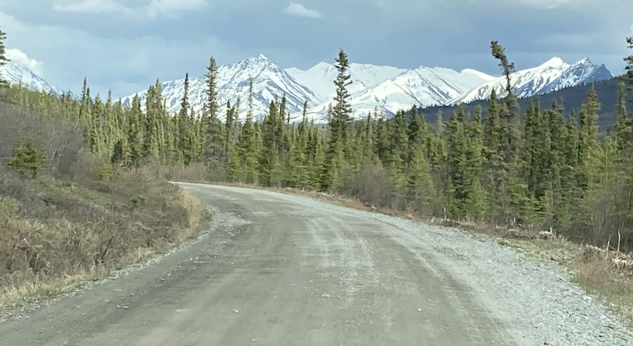
Our second stop is Sheep Mountain. In the words of the Milepost: "Double-ended paved turnout to south with picnic table; good photo op of Sheep Mountain to north and Chugach Mountains to south. Interpretive signs on Sheep Mountain gypsum and Dall sheep." In our words, we would say that the colors in Sheep Mountain are unlike any other mountains around them.
The signs explain that while many people mistake the orange hillside for copper or gold, it's actually iron-stained gypsum cooked up by a volcano. Dall sheep will travel many miles to supplement their diet with the nutrients found in these mineral licks on these mountains. Can you spot the tiny white dots on the side of the mountain that aren't snow?
We zoomed in with the good camera to see that the white dots had legs and a head, but they are still rather blurry at this distance. The sheep are here in the spring to lick the calcium, sodium, and sulfur salts to grow healthy bones and provide milk for the spring's babies.
At a random stop at Mile Post A121, Mark had spotted a porcupine. This slow-moving creature didn't seem to mind Denisa taking his picture.
She got a shot from the back that showed off its white quill-ladened tail that was ready to send painful quills into its enemies. Denisa wanted him to know that she is friendly.
Denisa was so focused on the porcupine that she totally forgot to look behind her. Mark pointed out a moose just crossing the road, showing off the sign for milepost 121.
We've only traveled 27 miles since our overnight camping spot, and we've already stopped six times. This is a beautiful highway! But the clouds began to roll in and soon our mountain views were shrouded by a light rain that turned into some snow that was turning the side of the road white. 


Because we are a little worried about the availability of gas in some remote areas, we filled up our tank in the little town of Glennallen for $3.68 per gallon. Ouch! At a stop at the visitor center, we heard the stories about a recent grizzly bear attack close to here. A surveyor surprised a grizzly, and his bear spray was no help to him in his backpack. He will survive, but it wasn't pretty.
It's at Glennallen that we turned south on the Richardson highway. Our next stop was the Wrangell-St. Elias National Park Visitor Center. This is the largest national park in the United States--six times bigger than the huge Yellowstone National Park. Wrangell-St. Elias includes four different mountain ranges and 9 of the 16 tallest mountain peaks in the United State. But most of this park is only available via bush plane. We stopped for the 20-minute national park film that put us to sleep, and a hike on the one-mile loop through the boreal forest. We know we are visiting in the early shoulder season, so it was fun to find these purple pasque flowers on this hike. The first flowers of the Alaskan spring!
We also took a picture of an old wooden fish wheel displayed at the visitor center. Alaskan residents with a special permit are allowed to put an automatic fishing contraption like this on the nearby Copper River to harvest some of the best salmon in Alaska. 
We drove by the river later, and took a distant picture of the modern metal fish wheels. The wheel is powered by the river current, which scoops salmon trying to swim upstream to spawn. The tilted basket on the wheel dumps the salmon into a large bucket. It seems a little like cheating.
The address of the national park visitor center is Copper Center, and we were expecting this to be a modern Alaskan town. Instead, we got a town that boasts that their city hall is in an outhouse. This section of the state seems to feature homes that have a minimum requirement of 5 junk cars in the front yard.
When the 800-mile-long Alaskan pipeline was built in the 1970s, it provided lots of jobs. The Milepost pointed out a parking area with pedestrian access to the pipeline.


A few miles later it mentions that bison often roam above the bluffs across the river. They were harder to find in the distance, but "Check"!
The Liberty Falls State Recreation Site is free for the first 30 minutes. That's long enough to take a picture of Liberty Falls. "Check"!
At the end of Edgerton Highway is the tiny town of Chitina. Pronounced /Chit-nah/, as we approached town there were three lakes along the road. At the third lake, Mark (of course) spotted a tiny brown dot on the far side of the water.
That would be another moose! Since arriving in Alaska less than 24 hours ago, we have already seen more moose than in all our travels combined!


No comments:
Post a Comment