6:00 a.m. We had a great night's sleep last night in our camp site on O'Brien Creek Road near Chitina, Alaska. We didn't hear even one car drive down that road overnight, and we think we are finally getting better at sleeping with the lights on. We woke up rested and refreshed, ready to start a long day. Today is forecast to have beautiful blue-sky weather, little wind, and perfect temperatures. We are planning to take advantage of that all day. When we left this morning, we just didn't know how long this beautiful day would be!
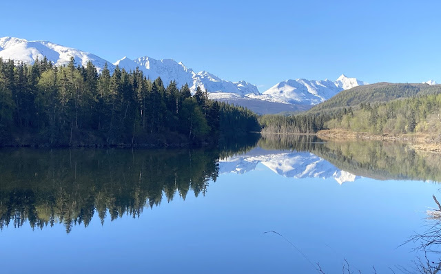
7:00 a.m. As we drove the van into the little town of Chitina, we stopped at the town lake for a perfectly mirrored picture of the snow-covered peaks that encircle us.
At another little lake stop, we caught this beaver working on a new construction project on this beautiful day.
8:00 a.m. We headed back up the Edgerton Highway to the Richardson Highway, where the Tibetan yaks were out enjoying the weather.
9:00 a.m. This drive was cloudy two days ago, so we took way too many pictures of the clear views as we traveled today. If you look at the picture below, you'll see an example of another interesting part of traveling in Alaska. The wavy white line on the edge of the highway illustrates what happens to roads that freeze and thaw and form frost heaves. Riding on some of the roads is a little like riding on a roller coaster as the asphalt dips and buckles.
We stopped in at Willow Lake for the view of the Wrangell Mountains that we had missed on the earlier cloudy drive. From the Milepost we even know their names, "From the left to right they are Mount Drum, with the smaller Snider Peak on its south flank; Mount Sandford; Mount Wrangell, with the pyramid-shaped Mount Zanett on its northwest flank, and Mount Blackburn." A few clouds hung on the top of the peaks on the right . . .
but Mount Drum was out in all its glory!
11:00 a.m. We turned west on the Glenn Highway, with a stop for more of that $3.68 gas to top off the tank. Then we went in search of a shower. We liked the "hot shower" sign on the highway at the turn-off for Tolsona Wilderness Campground, and paid the $10 day-use fee. We probably should have checked the showers before we paid, because they just opened for the season and the water smelled like rusty pipes. Our day-use fee entitled us to hike their two-mile hike down to the mud volcanoes though the peat-carpeted bog. We probably should have checked the trail status before starting because it was so muddy and boggy that we couldn't continue after a half-mile.
12:00 p.m. We were so muddy that Denisa headed back to the showers before we left.
This route is a repeat for us as we drove back the same way we came two days ago. But today we got to enjoy the blue-sky views of the Chugach and Talkeetna mountains.
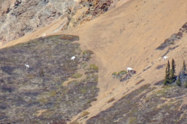
1:00 p.m. A stop at Sheep Mountain found more blurry Dall sheep on the mountain sides through the binoculars.
Again, the Milepost alerted us to upcoming sights: "A vista of incomparable beauty as the highway descends westbound in a long straightaway toward Glacier Point, also known as the Lions Head, an oddly formed rocky dome." Can you see the lion head in the picture below?
2:00 p.m. We stopped in again at Matanuska Glacier State Park area where we had been two days before. No moose this time, but the hillside was covered with dandelions in full bloom. We checked our exact picture from 48 hours ago, and there were no dandelions blooming on that yellow hillside you see below.
We couldn't help but take a blue-sky picture of Matanuska Glacier.
4:00 p.m. The roads had all been repeats so far, but at the town of Palmer we decided to make a detour for new territory. Denisa has a weakness for taking pictures of old bridges, so we stopped here by the Matanuska River where some of the locals were also enjoying this beautiful weather. After a long winter, a few people were even dipping their toes in the water.
6:00 p.m. We made the boring drive through the Anchorage metropolitan area, and headed south out of the city. We had already driven close to 300 miles and been on the road for eleven hours today. It's been a long time since breakfast, so we pulled into the parking lot at Potter's Marsh and cooked a meal on our camp stove on this long day. Then we walked the long wooden board walks that snake above the marsh in this wet valley.
This is usually a good place to photograph ducks and water birds, but the only birds posing today were swallows.

But it's also fun to zoom out to picture that same bird on its perch overlooking the scenery on this beautifully long day.
Potter's Marsh was a nice stop-over for cooking a meal before we head further south.
7:00 p.m. Normally, we would be looking for a camping spot by this time of the day. But we're taking advantage of this weather to drive to the Kenai Peninsula. To get there, we take the nice drive along the inlet of ocean water known as the Turnagain Arm. We parked at Beluga Point to take pictures of the calm water in the arm.
This is also where the Alaskan Railroad will follow these tracks around Turnagain Arm.
They were doing road work this evening, so we were stopped right beside the water, waiting for our turn at the one-way construction section. The still water in the inlet and the cloudless blue skies made for a pretty picture out our van window while we waited for our turn to continue down the road.
Some were soaring through the air, while we could spot the white head and tail feathers of those still in the water.
We had driven so many miles and our windshield was so covered with bugs that Denisa didn't take many pictures during our remarkable drive into the Kenai Peninsula. It's now 9:30 p.m. and we are finally getting serious about finding a place to camp tonight. Mark had read about a little-known spot very near the town of Moose Pass. We found the hard-to-see turn off from Seward Highway, and snagged this spot right next to the lake.
10:30 p.m. A walk on the beach showed the sun still lighting up the tops of the mountains across the lake, and the mountain mirrored in the water.
It has been a beautiful weather day with blue skies, no wind, and absolutely perfect temperatures! We've stretched this day to its max, traveling 350 miles, making more than a dozen stops, and taking hundreds of pictures. We should mention that we would never have traveled so far in one day when we have three weeks to explore Alaska. But we have friends joining us soon, and we're trying to save the best sights for them. That means we are driving more and back-tracking during the eight days we are traveling with just the two of us. So our itinerary isn't ideal or one we would recommend. But all along the way today we are reminded that a long day in Alaska is a great place to wander Gods wonders!


What a great day you had!! I'm enjoying your Alaska posts so much. Keep up the good work.
ReplyDelete